Winter Storm Watch – from NOAA

Winter Storm Watch

URGENT - WINTER WEATHER MESSAGE
National Weather Service Mount Holly NJ
336 PM EDT Mon Mar 19 2018

...A dangerous storm threatens heavy accumulations of wind driven sleet
and snow which may cause widespread power outages and make travel very
difficult at times...

.A pair of back to back noreaster`s Tuesday and Wednesday mornings
will merge into a single intense storm off the mid Atlantic coast
by Wednesday afternoon and then head for Nantucket Island early
Thursday. Travel plans will be substantially altered by Wednesday.
Consideration should be given to no unnecessary travel Wednesday
afternoon and evening when the heaviest snow with 1 to 3 inch per
hour accumulation rates should occur.

NJZ001-007>010-012-PAZ054-055-061-062-105-200900-
/O.NEW.KPHI.WS.A.0006.180320T2200Z-180322T0300Z/
Sussex-Warren-Morris-Hunterdon-Somerset-Middlesex-Carbon-Monroe-
Lehigh-Northampton-Upper Bucks-
Including the cities of Newton, Washington, Morristown,
Flemington, Somerville, New Brunswick, Jim Thorpe, Stroudsburg,
Allentown, Bethlehem, Easton, Chalfont, and Perkasie
336 PM EDT Mon Mar 19 2018

...WINTER STORM WATCH IN EFFECT FROM TUESDAY EVENING THROUGH
WEDNESDAY EVENING...

* WHAT...Heavy mixed precipitation possible....mainly as snow
  though some sleet and light freezing rain is possible Tuesday
  night.  Total snow accumulations of 5 to 8 inches, with
  localized amounts up to 12 inches, and ice accumulations of up
  to one tenth of an inch are possible.

* WHERE...Portions of northern and northwest New Jersey and east
  central, northeast and southeast Pennsylvania.

* WHEN...From Tuesday evening through Wednesday evening.

* ADDITIONAL DETAILS...Plan on difficult travel conditions,
  including during the evening commute on Wednesday. Significant
  reductions in visibility are possible. Roads in the hilly areas
  may become impassable if 1 to 3 inch per hour snowfall rates
  develop as expected Wednesday afternoon. Power outages are
  possible. Northeast to north winds should gust 20 to 30 mph at
  times.

PRECAUTIONARY/PREPAREDNESS ACTIONS...

A Winter Storm Watch means there is potential for significant
snow, sleet or ice accumulations that may impact travel. Continue
to monitor the latest forecasts.

SO BRUNSWICK PD: Roads in the Township are crippled. Widespread damage and power outages. Stay off the roads. nixle.us/9YRK5 Reply with a friend’s # to forward

CRANBURY POLICE: Heavy wet snow/winds creating dangerous conditions outside; falling branches, downed wires, poor road conditions. nixle.us/9YRG3

Wednesday Update – Parking Lot Camera

LAST UPDATE FOR TODAY MARCH 7th 1:15pm –

Please check the weather and road conditions.

Communicate with the department lead and travel safely.

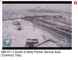
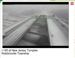
You can check traffic cameras here – http://www.511nj.org/cameras.aspx

Latest update for Cranbury – Posted 11:30am
…A dangerous nor`easter producing heavy, wet snow, will have
high impact and potential for numerous new power outages and some
tree damage from eastern Pennsylvania into northern and western
New Jersey…

.A compact but powerful nor`easter will skirt the New Jersey
coast this afternoon before heading toward Cape Cod this evening.
It will produce periods of heavy precipitation. All locations
along and west of the Interstate 95 corridor are vulnerable to
heavy snow, with the greatest uncertainty within 20 miles east of
Interstate 95. Otherwise, there is very high confidence that this
storm will make travel difficult or nearly impossible at times
late this morning and this afternoon across much of eastern
Pennsylvania and northern New Jersey, basically from near
Philadelphia, west and north to the New York state border and
beyond. Highest snow accumulations will be in the hilly areas

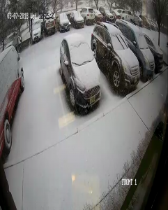
SAMPLE PICTURES FROM TRAFFIC CAMS

12:15pm


11:30am

10am

9am

Winter Weather Coming

Hello,

I’m encouraging you to drive when you feel capable to arrive safely. Please also communicate any changes to your schedule with the department lead.

We prefer https://www.wunderground.com for super local weather reports.

Wednesday Feb 7th

** Sleet & Ice ** Roads
WEST WINDSOR PD: ** Sleet & Ice ** Roads are currently safe for reduced speed travel but uncertain precipitation may change this nixle.us/9WSZ3

Fri Fed 2 – Looks wet is ice, careful!

Parking lot n side roads deceiving look wet but r slippery. Team almost bit it coming in

Wed 1/17 – Roads a bit slippery. Careful

Cecil reports “Parking lot a little slick”

Town reports “WEST WINDSOR PD: Roads slippery, leave xtra distance when stopping, Side roads & less traveled roads snow covered. Rt 1 Clear nixle.us/9TKTM”

Thursday 12pm Update – No 2nd Shift

Townships are asking people to stay off roads. Radar suggests the snow will stop around 4pm.

No 2nd Shift

No more scheduled updates. Team should travel as they feel safe.

Thursday 10am Update

A lot of the team made it in before the storm got too bad. Roads seems covered and very slippery. Travel as you feel safe. Some team members have needed to turn back home.

We are open and running, again just travel as you feel safe.

Next post 12:00

Top